Altimeter Ler Live Gps Geotracker v2.5 – Application to check weather conditions and other necessary information for mountaineering and cyclingUnlocked version of the app with access to all features
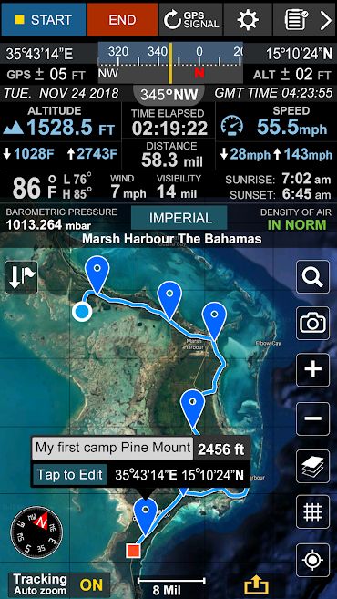
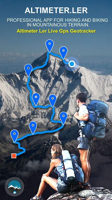
Nature trips and outdoor sports are very useful and uplifting, and doing them promotes mental and emotional health. Mountaineering and mountain biking are among these activities. As their names suggest, these activities have direct contact with mountains and heights. As you may know, the weather conditions in the mountains are much more variable and unstable than in cities. A weather that is called a light rain or drizzle in the city, can lead to floods and landslides in the mountains. Therefore, it is very important to have sufficient knowledge of weather and its predictions before going to the mountains and planning for such activities. Many experienced mountaineers estimate the future weather conditions based on the situation of clouds and the sky, but newcomers do not have such ability and often engage in such activities without any knowledge of the weather and its importance. In addition to weather conditions, access to a map and marking the route taken is one of the most important needs of any mountaineer. Many mountaineers use handheld GPS devices and paper maps to do so. Today, we have a program that does all of these tasks and more for you easily and automatically. Altimeter Ler Live Gps Geotracker is the title of an application for tracking routes and weather conditions in mountain-related activities, specifically for the Android operating system, developed and published for free on Google Play by the GPS Dragon software group. In addition to all the features mentioned, this program has a powerful and accurate barometer that will announce the air pressure at the entered point to you. This way, you can take full equipment and preparation to start your journey.
Some of the features and capabilities of the Altimeter Ler Live Gps Geotracker Android app:
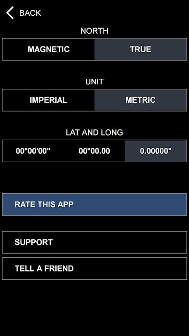
- Support for metric and imperial unit systems
- GPS accuracy indicator
- Air density indicator
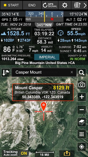
- Ability to search and mark different locations
- Integrated with various maps: Google Maps, Satellite Maps, Combined Maps, Standard Maps, Road Maps
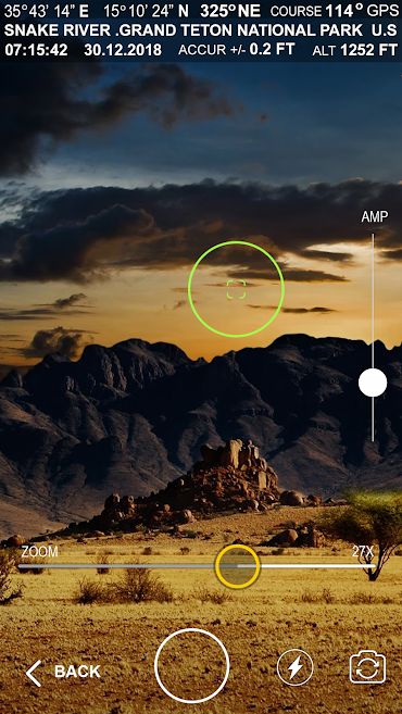
- Compass with camera
- Ability to take photos with geolocation coordinates
- Display of device position in relation to geographic directions
- Display of longitude and latitude
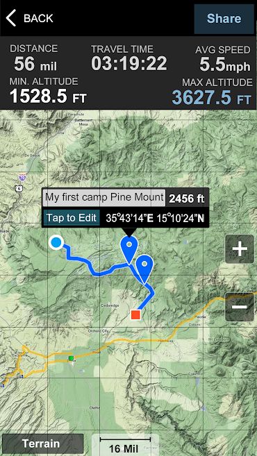
- Route tracking with various details: time, distance, average speed, maximum speed, altitude
- Complete weather information display with accurate details: temperature, wind, visibility, sunrise and sunset, minimum/maximum temperature
The Altimeter Ler Live Gps Geotracker app has received a rating of 4.2 out of 5.0 from Android users and is now available for free with all its features and capabilities on Usroid. This app is introduced at your request and you can download it with just one click.
![]()


Post a comment