Wildfire – NOAA Fire Map Info v2.0.1-internal – An app to access wildfire data in natural areas of the United States for Android Purchased version of the app for $0.99 on Google Play
Wildfires are one of the main factors causing the destruction of vegetation and forests worldwide. Many of these fires are caused intentionally or accidentally by humans, and due to the remoteness of forests, we often become aware of the fire only after it has spread extensively. In such cases, many trees are lost, and fire suppression efforts become much more difficult. To better and more quickly detect wildfires, satellite imagery can be used. The Office of Satellite and Product Operations (OSPO) is part of the National Environmental Satellite Data and Information Service (NESDIS). NESDIS is also part of the National Oceanic and Atmospheric Administration (NOAA) and the Department of Commerce. The OSPO was created by combining the Office of Satellite Data Processing and Distribution (OSDPD) and the Satellite Operations Center, and is responsible for maintaining comprehensive scheduling and data information for both Geostationary and Polar Orbiting satellites, as well as providing products derived from the collected data. The purpose of this office is to collect various satellite information and provide it for various purposes, one of which is controlling forest and wilderness wildfires. Today, we have a program that displays satellite information about wildfires in natural areas for you. The Wildfire – NOAA Fire Map Info application is a title for easy access to satellite information from NOAA/USGS about wildfires in forests and natural areas, specifically for the Android operating system, developed by QuantumTek Engineering software group and published on Google Play for $0.99. With this program, you can obtain accurate data on the status of wildfires in nature through various maps, news, and announcements.
Some features and capabilities of the Wildfire – NOAA Fire Map Info Android app:
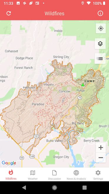
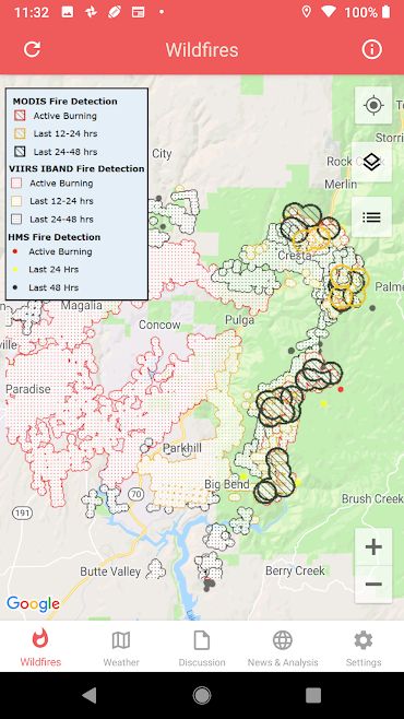
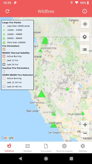
- Real-time wildfire status display: Displays real-time MODIS and VIIRS I-band NASA wildfire detection status accompanied by USGS analysis.
- Areas with dangerous wildfires: Displays NOAA and USGS information on current wildfire status.
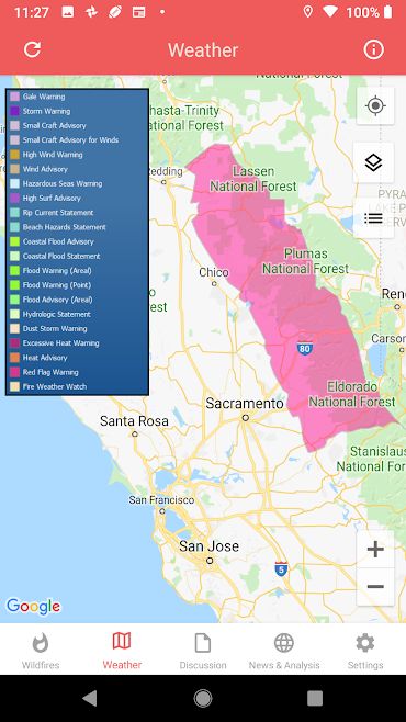
- Weather information: Displays near real-time data including NOAA HD weather radar, long-term hazards, short-term observations, and alerts along with wind speed and gusts…
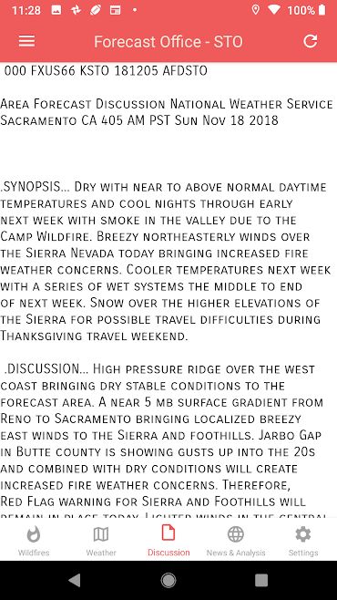
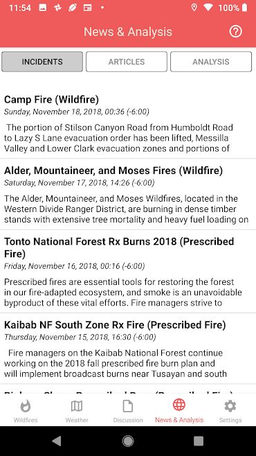
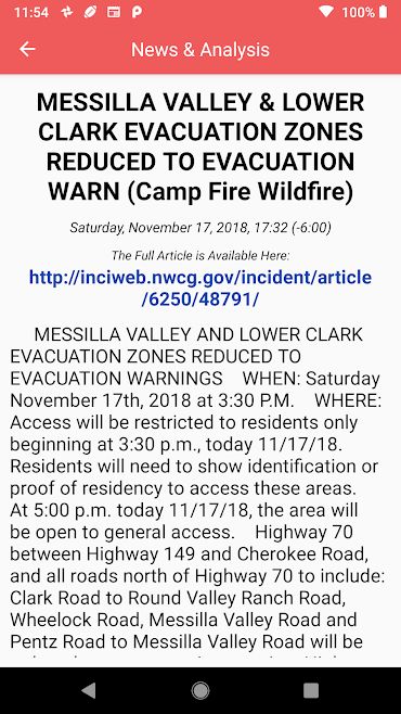
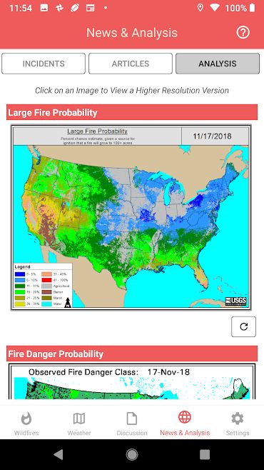
- News and analysis: Displays current status of national events and updates from responsible offices along with graphical analysis from various sources such as federal weather and weather agencies.
- Displaying various satellite maps.
The Wildfire – NOAA Fire Map Info application has received a rating of 3.9 out of 5.0 from Google Play users with their satisfaction. You can now get the purchased version of this app with all its features and capabilities for free from Usroid. This app has been introduced at your request and its latest version is available to you.


Post a comment